
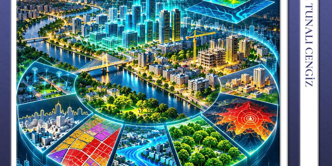

LiDAR (Light Detection and Ranging) is an advanced remote sensing technology that measures the travel time of laser pulses to generate high-precision, three-dimensional models of the Earth’s surface and the structures upon it. Combining deep engineering expertise, an advanced hardware fleet, and extensive project experience, Körfez Harita delivers end-to-end LiDAR surveying services that empower municipalities to make accurate decisions in urban management. Especially in densely built-up urban centers and heavily vegetated areas, LiDAR provides millimeter-level detail and rapid execution that traditional topographic methods cannot match.
Application Areas of LiDAR Technology in Municipalities
Municipalities leverage LiDAR technology across multiple domains in urban administration, smart city initiatives, and spatial planning processes:
- 3D City Models, Zoning Planning, and Skyline Analysis: Digital twins of entire cities or critical districts are created to reliably support zoning planning, urban skyline evaluations, solar/shadowing studies, and urban transformation initiatives.
-
Detection of Unlicensed Construction and Illegal Floor Additions: Existing building stocks are automatically cross-referenced with authorized plans and historical point clouds to detect illegal structures, unauthorized floor additions, facade alterations, and zoning violations with high precision.
-
Infrastructure, Drainage, and Flood Risk Analysis: High-accuracy Digital Terrain Models (DTM) are generated to optimize storm drain networks, run water flow simulations, and manage flood risks effectively.
-
Urban Forestry, Parks, and Green Area Management: Tree inventories, species identification, height/canopy measurements, and overall green space management across city parks, recreational areas, medians, and forested zones are rapidly recorded.
-
Transportation, Street Inventory, and Superstructure Management: Mobile LiDAR data enables up-to-date tracking of roads, sidewalks, curbs, medians, street lighting, signage, and urban street furniture, as well as highway damage and deformation analysis.
-
Disaster and Emergency Planning: Ground movement monitoring and risk mapping are conducted in areas vulnerable to earthquakes, landslides, and rockfalls.
-
Noise and Environmental Impact Modeling: Urban traffic and industrial noise propagation simulations are accurately computed using 3D building and terrain models.
-
Signage and Public Space Taxation: Commercial signage subject to taxation and encroached public spaces are precisely measured via LiDAR. By identifying undeclared assets, municipalities can manage their revenue tracking and taxation processes in a fast, fair, and transparent manner.
Click here to review our completed reference project conducted within the boundaries of the Istanbul Metropolitan Municipality for the TÜBİTAK MAM Earth and Marine Sciences Research Institute
Körfez’s Multi-Tiered LiDAR Solution Approach
Depending on project area size, budget constraints, and target accuracy requirements, Körfez Harita deploys an integrated hybrid approach using airborne, mobile, and terrestrial LiDAR technologies:
-
Airborne LiDAR (Manned & Unmanned Systems – ALS): For expansive urban fringes, metropolitan regions, development zones, forested belts, and major watershed corridors, airborne LiDAR systems integrated into both Unmanned Aerial Vehicles (UAVs) and manned aircraft are flexibly deployed according to project scale. This allows survey coverage ranging from small neighborhoods to entire municipal boundaries within short timeframes and at high point densities.
-
Mobile LiDAR Systems (Mobile Laser Scanning – MLS): Vehicle-mounted laser scanners map streets, avenues, and urban fabric seamlessly without disrupting traffic flow.
-
Terrestrial LiDAR (Terrestrial Laser Scanning – TLS): Preferred for historic structures, monuments, bridges, tunnels, statues, heritage sites, and complex urban assets requiring extreme detail.
Smart City Infrastructure with Körfez Haritacılık
Körfez Harita goes beyond raw point cloud capture; it converts raw field data into actionable geographic products designed for direct integration into municipal corporate networks. Key deliverables include:
-
Classified Point Clouds: High-density datasets categorized into ground, vegetation, buildings, and man-made structures.
-
Digital Terrain (DTM) and Digital Surface (DSM) Models: Topographic base maps accurately reflecting real ground elevation and above-ground elements.
-
Building Roof Models and Vector Base Layers: GIS-compliant vector layers prepared for urban planning frameworks.
Körfez Harita ensures that all deliverables integrate seamlessly with municipal Urban Information Systems (UIS / KBS) while providing technical training and ongoing support to municipal personnel. Körfez Harita is a trusted solution partner for local governments striving to manage their cities using up-to-date, reliable, and 3D geospatial data.
Frequently Asked Questions (FAQ)
What are the primary purposes of LiDAR data utilization for municipalities?
Municipalities utilize LiDAR data for 3D city modeling, identifying unauthorized construction and floor additions, flood and drainage analysis, tree inventory tracking, road infrastructure management, and urban space asset monitoring.
Which LiDAR methods does Körfez Harita utilize during project execution?
Depending on the project scope and geographical terrain, Körfez Harita employs a hybrid approach incorporating airborne (manned/unmanned) LiDAR systems, vehicle-mounted mobile LiDAR, and terrestrial laser scanning techniques.
Can LiDAR data be integrated into existing Urban Information Systems (UIS)?
Yes. All LiDAR deliverables are formatted to be GIS-compliant, allowing seamless and direct integration into municipal information systems.
Derya Tunalı Cengiz
Derya Tunalı Cengiz graduated from Selçuk University with a degree in Geomatics Engineering in 2011 and completed her Master’s degree in Land Management, Urban Transformation, and Real Estate Valuation at Konya Technical University in 2020. She currently serves as the Director of the Geodesy Department at Körfez Engineering Surveying Co. since 2012. She has contributed as an engineer and executive to over 100 projects within the company, specializing in GIS (Geographic Information Systems), Cadastre, Land Consolidation, and Geodesy.