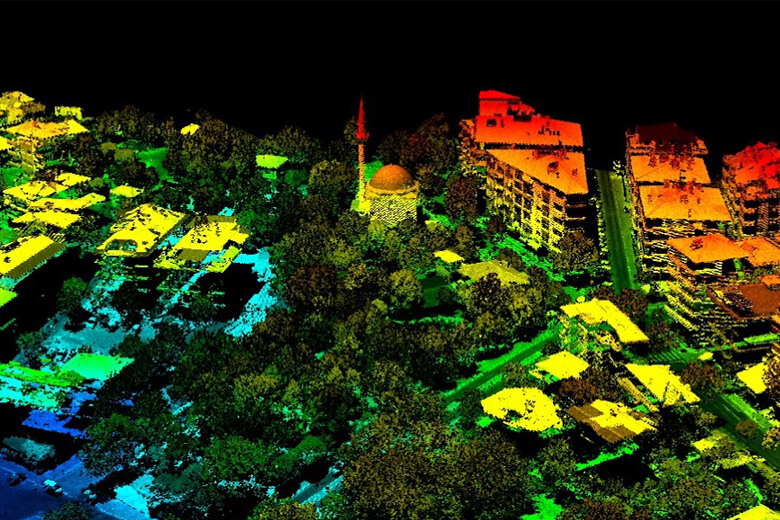
Hundreds of Thousands of Coordinate and Color Data per Second…
")
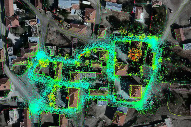
LIDAR is preferred in projects in terms of time/cost due to its features such as high-density data collection capability fast data collection opportunities, ability to process/classify dense data, less affected by weather conditions than aerial photographs, good performance in agricultural lands, ability to collect data from points that are difficult or impossible to access, optional point density, image area selection, data in forest areas, creating high-precision Digital Terrain Model (DTM) and Digital Elevation Model (DEM).
LIDAR Technology can also be used with aerial cameras to be incorporated into business processes along with photogrammetric images.
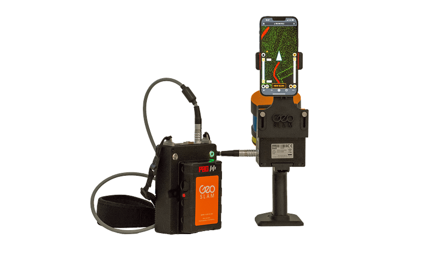
Körfez Engineering Surveying has the facilities and capabilities to collect LIDAR data from Aircraft, UAV, Mobile and Terrestrial Platforms according to the needs of the projects; It has the personnel experience to deliver the result products and necessary analyzes to its customers in the format they want. Our company offers high precision, innovative, fast and cost-effective solutions to its customers with ZEB HORIZON LIDAR and Equipments in inventory of company.
We are at your service in all locations that seem impossible to access with our reference projects, Hardware, Software and Information Technology Components…
Our Services
- Urban Environmental Analysis
- Map Production
- Mapping Flood Hazard Areas
- Hydrological and Hydraulic Modeling
- Natural Resource Management Applications (Calculation of Tree Heights, etc.)
- Volume Calculations for Excavation Works
- City Planning
- Transportation Lines Route Works (Highways, Railways, Infrastructure, etc.)
- Projects Realized in Coastal/Port Regions
- 3D City Modeling
- Visibility Analyzes for Military and Civilian Purposes
- Energy Transmission Lines Applications
- Scanning for Cadastral Data Production
and more…
Hardware & Software
- TC-KRF – Cessna T206 H Piston Engine Airplane
- ULTRACAM X – Large Format Multispectral Aerial Camera
- PHASEONE IXM-RS150F RGB Aerial Camera
- SOMAG AG JENA GSM 3000 Mount
- APPLANIX Flight Management System
ZEB HORIZON LIDAR and Equipments
- DELL POWEREDGE R730 Server
- 250 TB NETGEAR & QNAP Online Storage Unit
- 250 TB Offline Storage Unit
- HP Z820 Workstations
- Stereo Photogrammetric Workstations
- Desktops and Laptops
- ERDAS IMAGINE Remote Sensing Software
- GEOSLAM HUB LIDAR Software
- MICROSTATION CAD Software and Plugins
- QGIS Software
- CLOUD COMPARE Software
Gallery