Accessible and Large Lands, Economical Enterprise, Maximum Benefit…
")
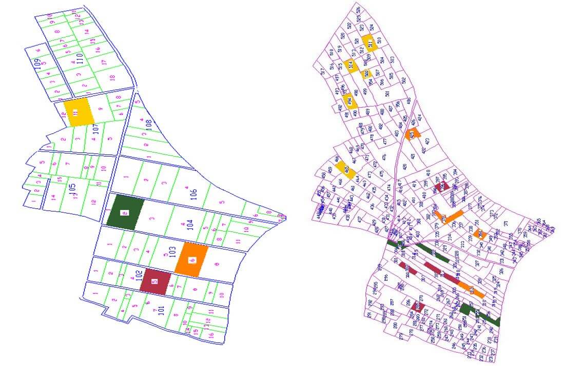
The process of combining, shaping and rearranging fragmented, dispersed and irregularly shaped parcels that do not allow economic agricultural activities for various reasons, in accordance with the principles of modern agricultural management and for the development of irrigation services, is called “Land Consolidation”.
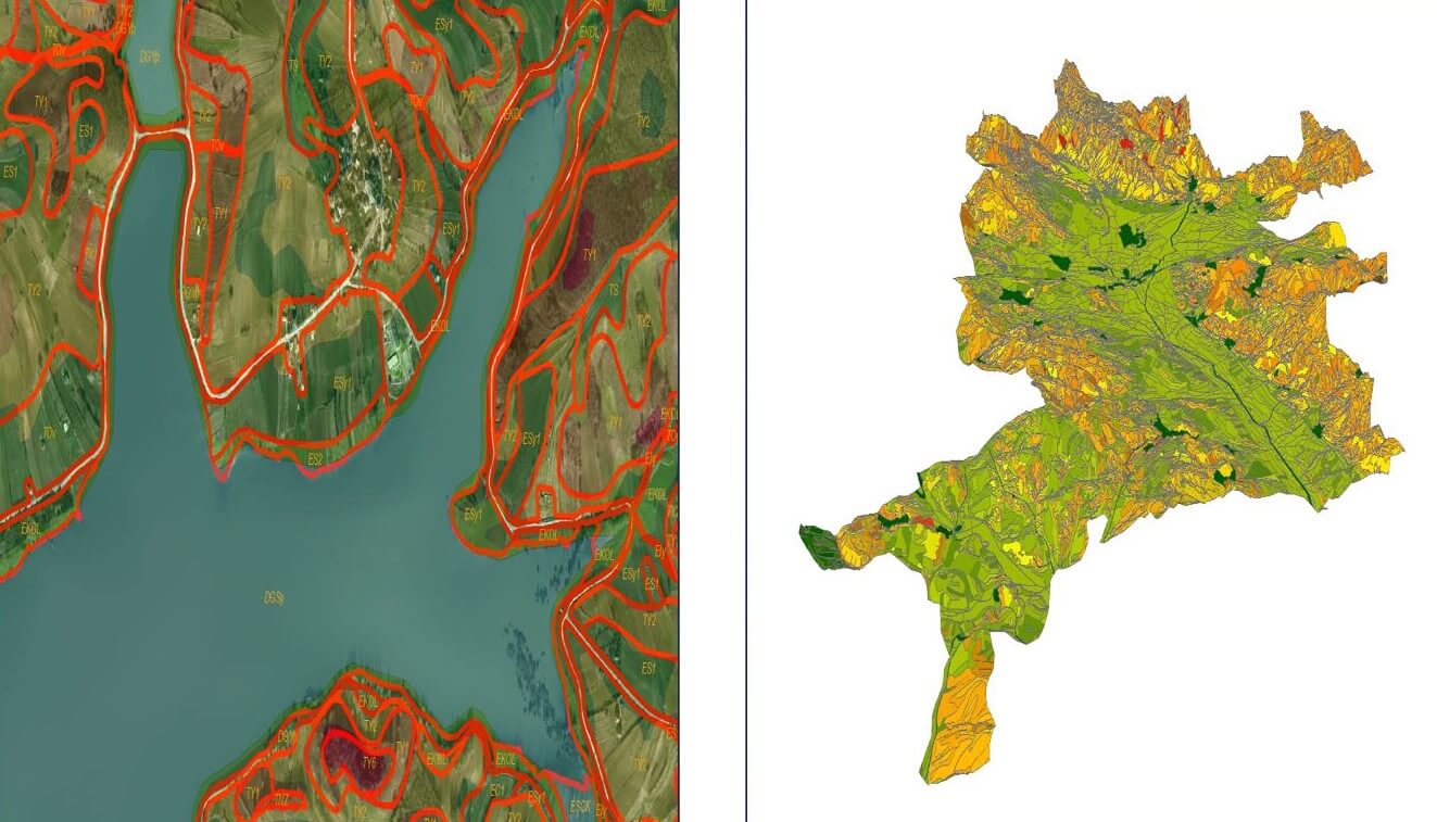
In our land consolidation processes, together with our strong and expert team, we create a detailed digital model of the land using photogrammetry techniques and reference this model according to the earth coordinate system. Thus, we can precisely analyze the topography, slope and other important features of your agricultural fields. Within the scope of our Land Consolidation and On-Field Development Services, we provide a more sustainable and profitable agricultural management by increasing your agricultural efficiency.
Moreover; We are with you in your project processes in the production of three-dimensional physiography and soil maps with our experienced Agricultural Engineer and Photogrammetry Operator staff.
As Körfez Engineering Surveying, we offer special solutions to suit your Land Consolidation Projects needs with our customer satisfaction-oriented approach, technology-based solutions and expert staff.
Our Services
- Photogrammetric Data Production and Analysis
- Map Services
- Geodetic Measurements and Engineering Services
- Basin Detection
- Irrigation Projects
- Production of Soil-Physiography Maps
- Slope Maps
- Identification of Fixed Facilities
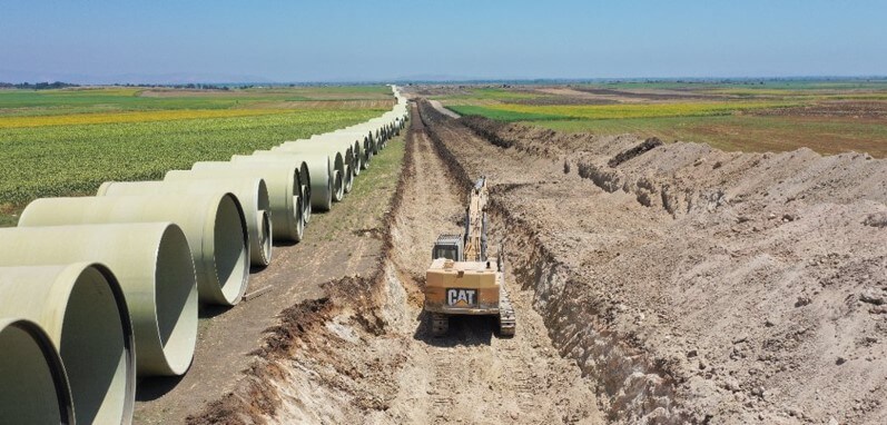
- Excavation Works
- Road Constructions
- Infrastructure Works
and more…
Hardware & Software
- LEICA GEOSYSTEMS GPS Receiver and Equipment
- Total Station Cihazları ve Donanımları
- Dijital Nivo Cihazları ve Donanımları
- ZEB HORIZON LIDAR and Equipment
- DELL POWEREDGE R730 Server
- 250 TB NETGEAR & QNAP Online Storage Unit
- 250 TB Offline Storage Unit
- HP Z820 Workstations
- Desktops and Laptops
- Wireless and Online Communication Devices
- Printers
- Plotters
- Photocopy Machines
- Passenger Vehicles
- Off-Road Vehicles
- LEICA GEO OFFICE Software
- NETCAD Software and Add-ons
- MICROSTATION CAD Software and Plugins
- Land Consolidation Software
- Cadastral Services Software
Gallery