Cadastral Maps with Latest Technology and Precise Measurements…
")
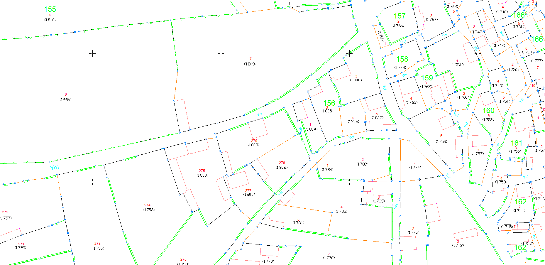
In the Turkish Cadastral Law, cadastre is defined as “the process of determining the legal status and rights over immovable properties by indicating their boundaries on land and maps.”
As Körfez Engineering Surveying, we offer a comprehensive approach to obtain reliable data on ownership and land use with our technology-based solutions and expert team in cadastral renewal and update applications. In our cadastral renewal process, we analyze land boundaries and property units in detail with the sensitive data we obtain using our aerial photogrammetry, satellite and terrestrial surveying equipment and our state-of-the-art mobile lidar device. While these analyzes provide the opportunity to update and correct existing cadastral maps, they also enable the integration of new data.
The cadastral renewal and update applications we offer as Körfez Engineering Surveying respond to the needs of our customers in the best way by providing fast, accurate and economical solutions. With our strong and experienced team and innovative approach, we would be pleased to support you in keeping cadastral data up to date and providing services with accurate information.
Our Services
- Cadastral Renewal
- Cadastral Update
- Cadastral Digitization
- Photogrammetric Studies for Cadastral Projects
- Border Detections with Stereo Measurement
- Measurement-Drawing with Mobile LIDAR
and more…
Hardware & Software
- LEICA GEOSYSTEMS GPS Receiver and Equipment
- Total Station Devices and Hardware
- Digital Level Devices and Equipment
- ZEB HORIZON LIDAR and Equipments
- DELL POWEREDGE R730 Server
- 250 TB NETGEAR & QNAP Online Storage Unit
- 250 TB Offline Storage Unit
- HP Z820 Workstations
- Desktops and Laptops
- Wireless and Online Communication Devices
- Printers
- Plotters
- Photocopy Machines
- Passenger Vehicles
- Off-Road Vehicles
- LEICA GEO OFFICE Software
- NETCAD Software and Add-ons
- MICROSTATION CAD Software and Plugins
- Cadastral Services Software
Gallery