Smart Data, Accurate Analyzes…
")
Geographical Information System (GIS) is a database management and information system which helps the organization at every stage in the collection of the location-based observations obtained from the graph and non graphic data collection, keeping, processing and performing in integrity of the functions.
Our main goals that we focus on in our Geographic Information Systems services are;
- To develop applications where the data collected with a multidisciplinary approach corresponds practically and scientifically to the end user,
- To maximize our analysis capabilities by collecting effective and accurate data,
- To provide technological solutions that support fast and easy access to data, analysis and targeted results,
- To direct future planned studies towards their goals by integrating time-based (4-Dimensional) data into the system when necessary,
- To popularize the use of digital and online maps, to contribute to the protection of nature by minimizing the use of paper maps,
- To leave our footprints in the history of developing technology.
Our Services
- Satellite Imagery and/or Aerial Photography Supply
- Data Generation from Photogrammetric Images (Height Models, Orthomosaics, Vector Data)
- Format Conversions of Raster and/or Vector Data
- Collection of Attribute Information from the Field and/or Relevant Institutions
- Establishing Online and/or Desktop Database Infrastructure
- Data input
- 4D Analysis of Raster and/or Vector Data
- Physiography (Soil) Mapping
- Flood Risk Analysis
- Noise Map Production
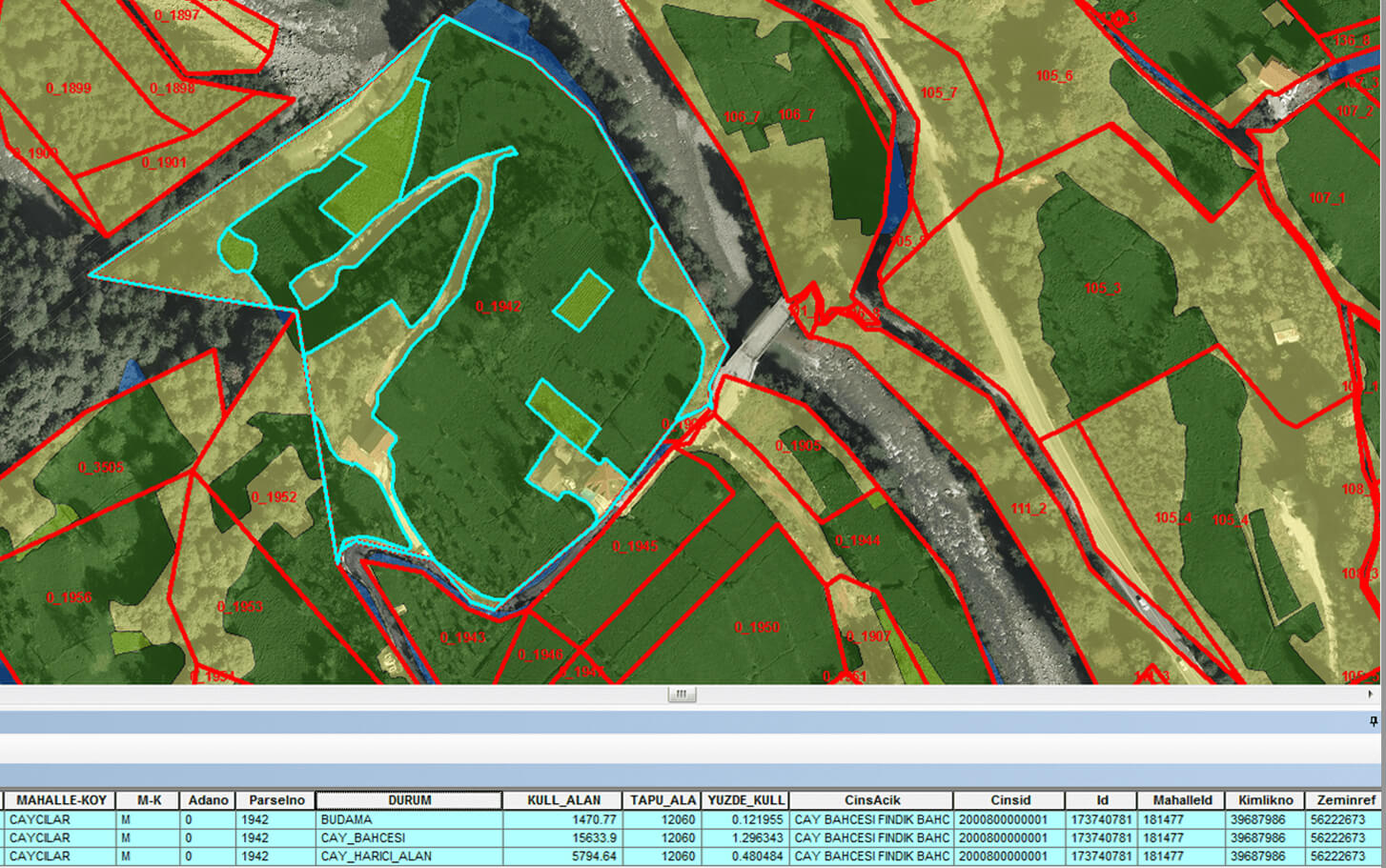
- Management of Agricultural Lands
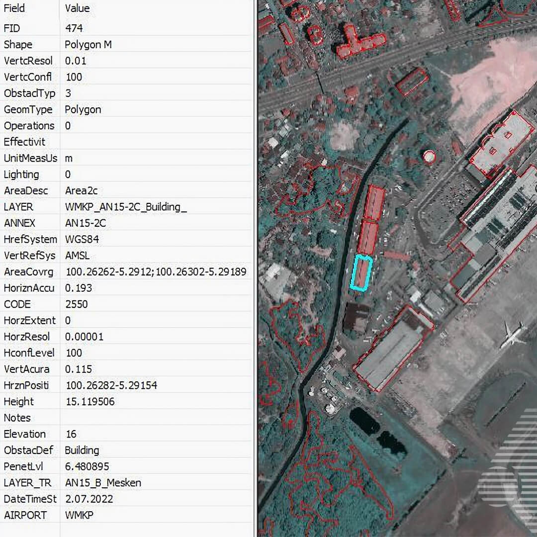
- Airports Obstacle Detection
- Basin Identification and Water Management Analyzes
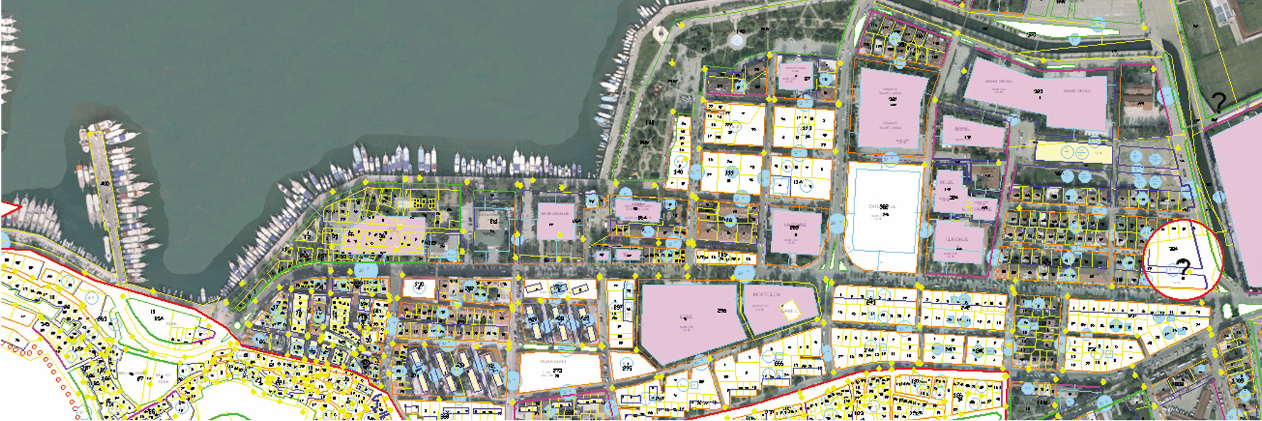
- Solution of Cadastral Uncertainties
and more…
Hardware and Software
- TC-KRF – Cessna T206 H Piston Engine Airplane
- ULTRACAM X – Large Format Multispectral Aerial Camera
- PHASEONE IXM-RS150F RGB Aerial Camera
- SOMAG AG JENA GSM 3000 Mount
- APPLANIX Flight Management System
ZEB HORIZON LIDAR and Equipments
- DELL POWEREDGE R730 Server
- 250 TB NETGEAR & QNAP Online Storage Unit
- 250 TB Offline Storage Unit
- HP Z820 Workstations
- Stereo Photogrammetric Workstations
- Desktops and Laptops
- ERDAS IMAGINE Remote Sensing Software
- GEOSLAM HUB LIDAR Software
- INPHO Photogrammetric Triangulation and Compensation Software
- LPS Photogrammetric Supported Drawing Software
- MICROSTATION CAD Software and Plugins
- NETCAD Software and Add-ons
- QGIS Software
- Web Based Solutions
Gallery