| PROJECT CATEGORY | : PHOTOGRAMMETRY & GIS & LIDAR PROJECTS |
| CODE | : PGL0127 |
| EMPLOYER | : GEN. DIR. FOR THE PROT. OF NAT. ASSETS |
| YEAR | : 2023 |
| PROJECT AREA | : 1735.27 ha |
| FLIGHT LENGHT | : 82 km |
DESCRIPTION |
|
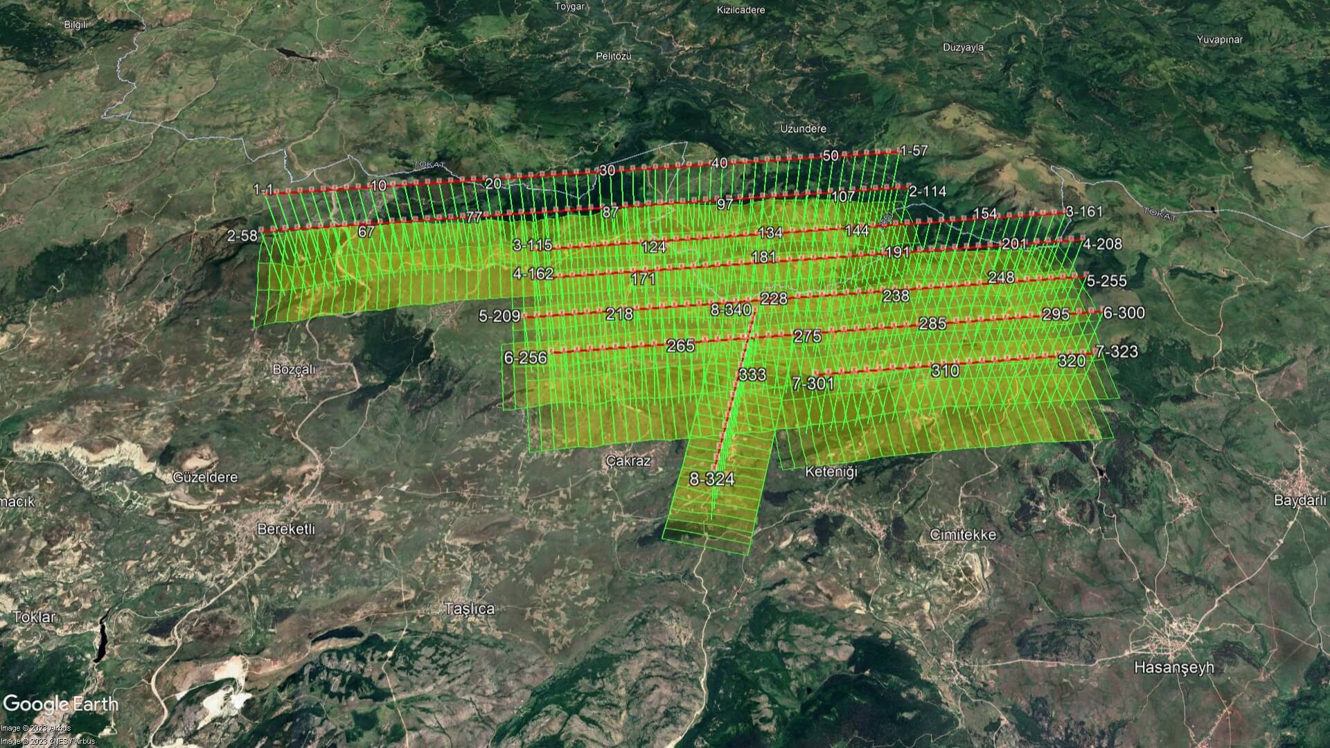
| 1/1000 scale photogrammetric map and orthophoto production of our project, which aerial photographs with 8 cm GSD were taken with our TC-KRF aircraft and PHASEONE IXM-RS150F aerial camera on July 21, 2023, were completed and delivered with reportings. | |
Tokat-Bozçalı WEPP Project, 1/1000 Scale Photogrammetric Map Production