| PROJECT CATEGORY | : PHOTOGRAMMETRY & GIS & LIDAR PROJECTS |
| CODE | : PGL0032 |
| EMPLOYER | : BP / BTC |
| YEAR | : 2010 |
| PROJECT AREA | : 1200000 |
| FLIGHT LENGHT | : |
| DESCRIPTION | |
|
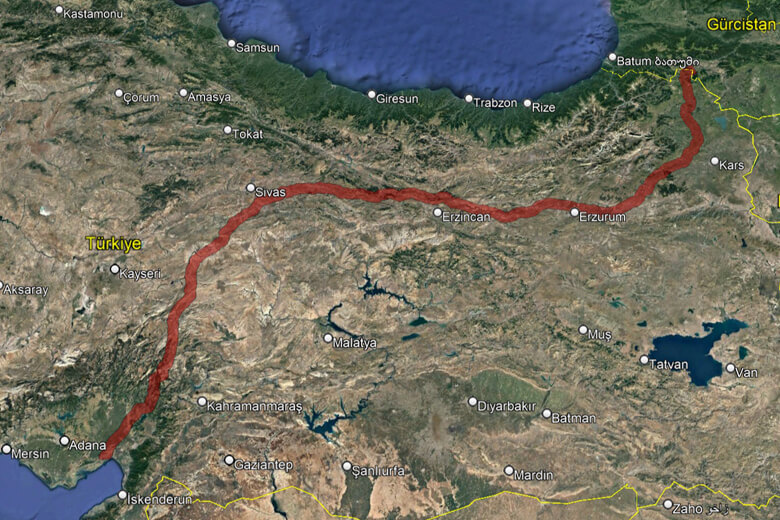
Baku-Tbilisi-Ceyhan Oil Pipeline area, which is 1071 km long and 12 km wide; In 2010, 2011, 2012, 2013, 2014, photogrammetric ground control points facility-measurement-calculations, creation of digital high and digital terrain models, production of orthophoto maps and preparation of Fly-Through simulations were completed. Environmental Impact Assessment Analyzes, Safety Risk Analyzes, Pipeline Deformation Risk Analyzes were carried out and finalized by presenting useful results to the employer in order to determine the existing risks and to detect potential risk elements in advance and take precautions. In addition, observation flights and aerial imaging for security purposes were carried out by Gulf Mapping Planning in 2017. |
|
Aerial Imagery And 5000 Scale Orthophoto Production For Baku-Tiflis-Ceyhan Pipe Line